
Phra Samut Chedi

PLACE: PHRA SAMUT CHEDI (พระสมุทรเจดีย์)
LOCATION: Pak Khlong Bang Pla Kot sub-district in Phra Samut Chedi District
GPS Coordinates: 13.600380, 100.586837
OPENING HOURS: Daily
ADMISSION: Free
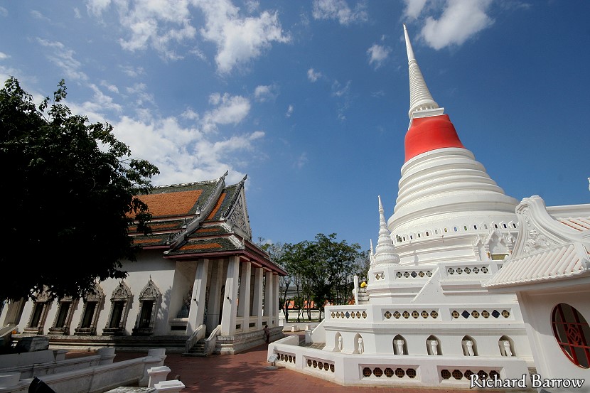
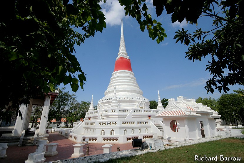
One of the first sights that greeted foreigners arriving in Thailand 150 years ago was a brilliant white pagoda on an island in the middle of the river. The locals called it ‘Phra Chedi Klang Nam’, or Pagoda in the river. The island was partly natural caused by the accumulation of sand brought down by the flood waters. Over the years the river has silted up even more causing the island to become part of the west bank. Now the temple is more known by its official name of Phra Samut Chedi.
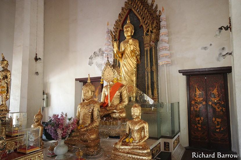
King Rama II was the first to have the idea of a temple in the middle of the river. He noticed a natural sandbank in the river at Paknam. He thought it would make the ideal location for a temple. However, he died before his dream could be realised. The task was taken over by King Rama III who started work on the temple on Tuesday 30th October 1827. It was completed seven months later at a cost of 233 chang (18640 baht). The Sri Lankan-style chedi stood 20 metres high. It was bell-shaped and topped by a ringed spire. To one side was a small temple which contained a brass image of the Buddha. The chedi was improved some 30 years later by King Rama IV who wanted to show all visitors to Thailand that his people were Buddhists. He decided to increase the height of the chedi to 38 metres and he placed inside 12 sacred relics of the Buddha, Phra Chaiyawat and a Buddha image.
In 1862, Anna Leonowens wrote the following about her first view of Phra Samut Chedi: On an island there “is perhaps the most unique and graceful object of architecture in Siam; shining like a jewel on the broad bosom of the river, fantastic and gilded, flashing back the glory of the sun, and duplicated in shifting shadows in the limpid waters below… Visiting this island some years later, I found that this temple, like all other pyramidal structures in this part of the world, consist of solid masonry of brick and mortar. The bricks made here are remarkable, being fully eight inches long and nearly four broad, and of fine grain. There are cornices on all sides, with steps to ascend to the top, where a long inscription proclaims the name, rank and virtues of the founder, with dates of the commencement of the island and the shrine. The whole of the space, extending to the low stone breakwater that surrounds the island, is paved with the same kind of brick, and encloses, in addition to Phra Chedi, a smaller temple with a brass image of the sitting Buddha. It also affords accommodation to the numerous retinue of princes, nobles, retainers, and pages who attend the king in his annual visits to the temple, to worship, and make votive offerings and donations to the priests.”

In one of the temple buildings there is an interesting mural showing the history of the province. There is an annual temple fair here for nine days and nine nights in the 11th lunar month (usually in October). The temple is the symbol for Samut Prakarn province.
Map for Phra Samut Chedi
Other attractions in this area:
[column-group]
[column]
Phra Samut Chedi District:
[/column]
[column]
Pak Khlong Bang Pla Kot sub-district:
[/column]
[/column-group]
Samut Prakan is divided into six districts: Amphoe Mueang, Amphoe Bang Bo, Amphoe Bang Phli, Amphoe Phra Pradaeng, Amphoe Phra Samut Chedi and Amphoe Bang Sao Thong. Click on the links to see tourist attractions from each of those districts. Or click here to see a Map of Tourist Attractions in Samut Prakan Province.